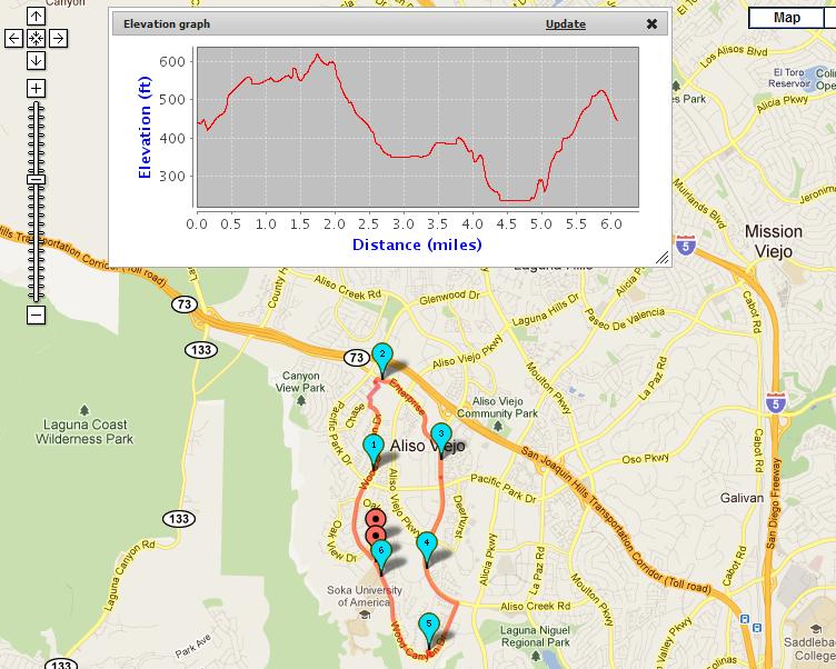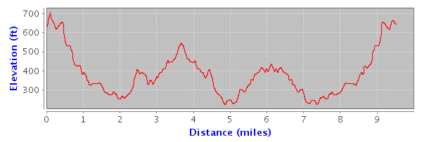
Now you don't have to wonder whether you will encounter any large hills on your running, walking, cycling, or hiking route. The elevation graph gives you a clear indication of where the hills are and the total elevation increase or elevation decrease along your route.
The Elevation/Altitude graph displays the elevation in feet or meters for your selected route. The units in the Elevation/Altitude graph can be changed by selecting "Miles" or "Kilometers" in the heading column of the route table. The Elevation Graph will update dynamically whenever you select a route from the route table.
To use the elevation graph feature, be sure that you are logged in before saving your Map Pedometer route. Elevation graphs are currently only available for Map Pedometer routes which were saved while you are logged in.
If you are not a registered user, you can become a Map Pedometer registered user for free. To log in or to register for a free Map Pedometer account, visit the Map Pedometer Log in/Registration page: http://www.mappedometer.com/forum/ucp.php?mode=login
Please post your feedback here if you have any comments about the Elevation Graphs or encounter any issues.
UPDATE: 11/6/11 - Elevation graphs have been added to the Map Pedometer home page. Read the Nov 06 post below for details on the home page elevation graph.